![]()
News
15th April - A successful weekend of racing in the Galloway hills - I've put a short report here Report 2026.htm
8th April - Tracking links are below:
Bruce's Crown - https://live.opentracking.co.uk/bcr2026/
Heart of Granite - https://live.opentracking.co.uk/hog0426/
5th April - Entries for both races will close tonight and I'll be sending out a
reminder about Registration, Start times and the Kit list tomorrow morning for
both races. The weather is looking dry (ish) but cold probably with a flurry of
snow forecast on Merrick on Thursday / Friday. There is camping available at the
Event Start / Finish for both Friday and Saturday nights. It's on the parking
field and is grass and we've only got toilets, no showers.
17th March - Exciting news in that we have opened up Bruce's Crown to solo runners. It will certainly be a test of endurance and resilience to complete the course as a solo. Anyone wishing to enter just follow the link to SiEntries and then put your name or make a Team name up when it asks for that. Your entry will get vetted and then you will be invited to accept and pay for the entry.
We have changed the Kit requirement for the Bruce's Crown - Teams and Solo - see Rules.htm
Harveys Maps have kindly given us a discount code which will be in your confirmation email. If you have already entered please email me and I will send you the discount code.
15th March - Everything is on track for the races in April. Heart of Granite entries are doing well, while Bruce's Crown are stable - both entry windows will stay open until 5th April.
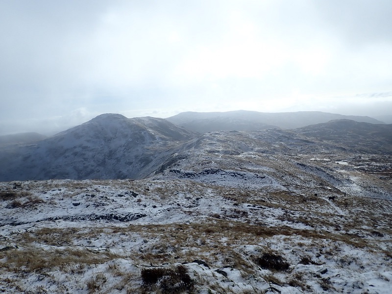
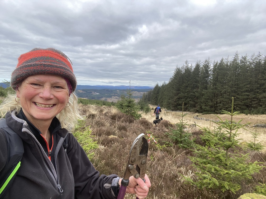
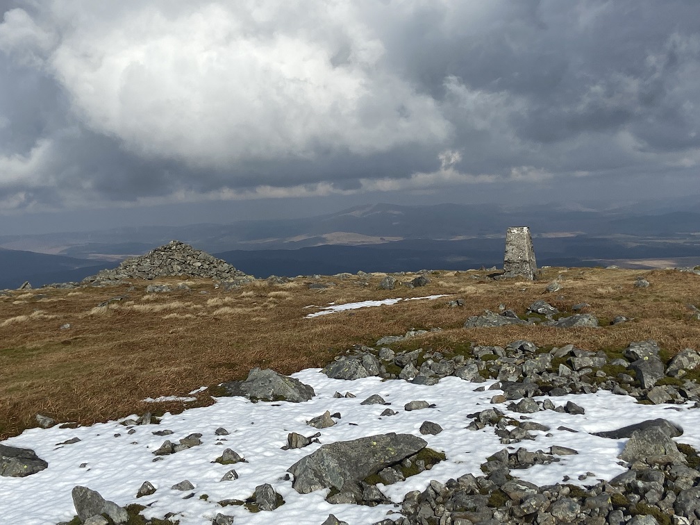
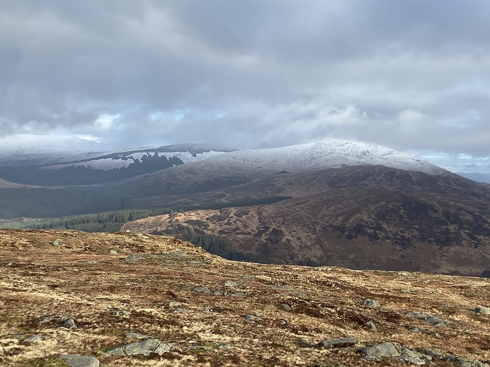
Ground conditions are pretty good with the colder temperatures and snow flattening down the vegetation. Obviously it is fairly wet underfoot but hopefully we get a bit of dry weather before mid April. I was out on Legs 1 and 2 yesterday and have put a selection of photos Bruce's Crown Legs 1 and 2 up.
1st November - In October I passed on the engraved trophy to Jo Scott in Penrith and I hope it's got pride of place on his mantelpiece. Other than that there is not much news Entries are open for both Bruce's Crown and Heart of Granite (and Cairnsmore) on SIEntries - the links can be found on the relevant pages. For the next edition we will be keeping the Start times as per September (8am to 9.30am for BC) and 9am and 10am for the Heart of Granite. Both races will descend the tourist path which although rough is better than the Merrick race route in everyone's opinion. I have been toying with the idea of a shorter race which would ascend Buchan Hill and descend Merrick and will keep you posted if I get this off the ground.
Anyone wanting to recce please feel free to contact me and I'll help out if I'm around.
.JPG) 15th
September - We had a very successful weekend at the Bruce's Crown and Heart of
Granite races. 30 runners set off on the Heart of Granite race and with 7
retirees we had 23 runners finish the very wet and overgrown course. The weather
was supposed to be showers however the showers followed on from one another and
the sun was only glimpsed a couple of times. There was also clag around on the
hills which made navigation tricky. Well done to everyone who got round - I can
assure you there is a lot less vegetation in April! I had said on the Map and
instructions that we had to use the Merrick Hill race route so I've added 5
minutes onto everyone's times that used the Tourist path as there is a clear
distinction that it's quicker when you study the splits. The winner was
Gregor Stewart in an impressive 4.09 minutes, followed by James Chapman in
04.18 minutes. First Lady was Emma Stuart in 4.31 hours. A massive well done to
Glyn Jones, the original creator of both the Bruce's Crown and the Heart of
Granite (different, even worse route) who finished in a time of 11.05 hours and
very happy and smiling. He won the V75 prize! All the results are on
https://results.opentracking.co.uk/event/hog0925
15th
September - We had a very successful weekend at the Bruce's Crown and Heart of
Granite races. 30 runners set off on the Heart of Granite race and with 7
retirees we had 23 runners finish the very wet and overgrown course. The weather
was supposed to be showers however the showers followed on from one another and
the sun was only glimpsed a couple of times. There was also clag around on the
hills which made navigation tricky. Well done to everyone who got round - I can
assure you there is a lot less vegetation in April! I had said on the Map and
instructions that we had to use the Merrick Hill race route so I've added 5
minutes onto everyone's times that used the Tourist path as there is a clear
distinction that it's quicker when you study the splits. The winner was
Gregor Stewart in an impressive 4.09 minutes, followed by James Chapman in
04.18 minutes. First Lady was Emma Stuart in 4.31 hours. A massive well done to
Glyn Jones, the original creator of both the Bruce's Crown and the Heart of
Granite (different, even worse route) who finished in a time of 11.05 hours and
very happy and smiling. He won the V75 prize! All the results are on
https://results.opentracking.co.uk/event/hog0925
Bruce's Crown Teams set off from 8am with Steve's Burgess's Over t'Hill and then the running teams from 9.10 to 9.25am. I felt for them as the weather was wetter than forecast and windy too but apparently the Rhinns of Kells were clear and pretty dry. The teams all seemed to stay relatively together and there was a good competition going on between the men's teams and the mixed with the ladies team. One team took the direst line from Portmark to CP11 and then from CP12 up to Shiel Hill. Always brave to head into these forests but it looked like the gamble paid off. Well done to Jo Scott and Nigel Wright of Team Flapjack who completed the race in 15.47, followed by the two Alasdair's in Double Trouble in a time of 17.05 hours. First Ladies, Sweaty AF consisting of Fiona Horsfield and Alison McGill were 3rd overall in a time of 20.32 hours followed by the Mixed Team - the Moopsters of Mike Brooks and Sarah Wheeler in 21.06. Steve Burgess's Team, Over the Hill, finished in a time of 26.06 however were awarded a time bonus as they waited for MRT help on Coran of Portmark with a suffering team member for an hour. All the results are on https://results.opentracking.co.uk/event/bcr0925 and I've asked Opentracking if we can display all the team members as well as Team leaders so hopefully that will be done soon.
Thank you to Forestry Land and Scotland for permission, Crafty Brewery for the bottles of gin, Inov8 for vouchers and Owens Butchers for bread rolls and bacon/sausages. And from me a massive thanks to Galloway Mountain Rescue for making this all happen with me.
The next edition is already up and taking entries on SiEntries
Bruce's Crown here - https://www.sientries.co.uk/event.php?event_id=15611
Heart of Granite here - https://www.sientries.co.uk/event.php?event_id=15610
Photos taken of Heart of Granite and Bruce's Crown race and prize giving Please send any photos to me and I'll add them to the Gallery
11th September - Everything is underway for the weekend and we're weather watching as you will be of course! The Opentracking trackers have arrived and the pages are set up for people to follow the race live as it progresses.
The Bruce's Crown link is here
 https://live.opentracking.co.uk/bcr0925/
and how it works is that the Team Captain's time will be recorded through the
checkpoints while the team members are tracked but not recorded.
https://live.opentracking.co.uk/bcr0925/
and how it works is that the Team Captain's time will be recorded through the
checkpoints while the team members are tracked but not recorded.
The Heart of Granite link is here https://live.opentracking.co.uk/hog0925/
If early starters can let me know before the event they wish to start early that would be helpful as I can change the Start time on Opentracking now, otherwise I can alter the start time on the day at Registration.
27th August - Timings for Bruce's Crown teams. Last year I allocated times but in practice teams started when they liked. Looking at the Team's experience only Steve's team (Over t' Hill) is a Walking team and so they will set off at 8am on Saturday. The Heart of Granite Early starters will set off at 9am. Then the rest of the Bruce's Crown teams can start whenever they like between 9am and 10am. At 10am the main Heart of Granite race sets off.
It could be busy to Lamachan up the valley but I'm sure everyone will be happy to let runners by and let them squash the grass down. I'm looking forward to seeing you all on Friday / Saturday morning and over the weekend.
Please Note: I am away from Friday 29th August in Switzerland doing the Swiss Peaks 380 with Kirsty Hewitson, so if you send me an email please be patient and I will respond when we finish the race!
23rd August - Preparations are under way and we had a meeting last week with the Merrick Hill Race RO too - Craig. Don't forget if runners want a shorter, out and back option they can enter Merrick Hill Race on the link below or on the day at Bruce's Stone carpark. Entries for Bruce's Crown and Heart of Granite will close on Sunday 7th September and we can't take entries on the day.
I have also cut the path back from Caldons today as it was still overgrown and hopefully the undergrowth might have died back a bit also.
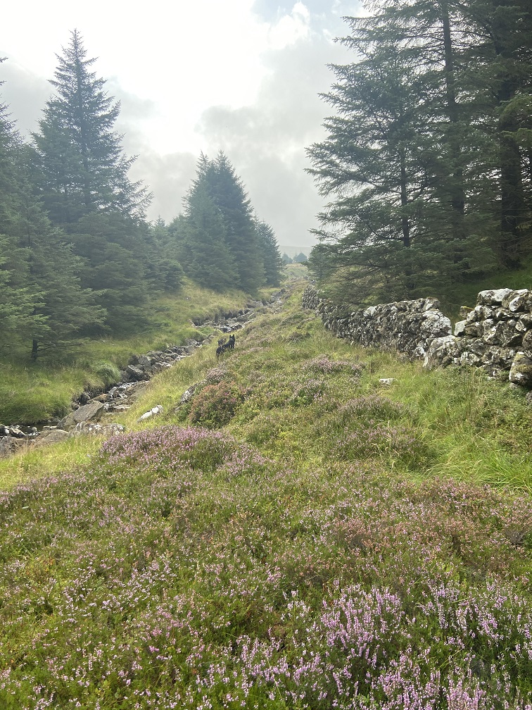
August 14th - I ran round Heart of Granite and I will apologise that the undergrowth will make this race harder than it would have been in April. A few things I found
1) At the end of the Rig of the Jarkness you can go down the left handside of the ridge direct to the grassy area. Because of the height of the tussocks then turn left and go parallel to the stream and then turn right to the stream. On the photos you can see my dogs and that is a path.
2) At the end of the path towards Loch Enoch you take the left fork towards Merrick before you get to the lake. You can also take another left form and drop a little to climb over the end of Rig of Lock Enoch.
The last photo in the photo gallery is of the extra cakes I baked after my recce as everyone is going to need them when they finish! Me included!! Heart of Granite recce Aug 2025
8th August - We will operate an Early Start on the Heart of Granite which will be 9am. This is for older and steadier runners only as the manned checkpoint at Axe Stone (CP3) will not open until 10.30am. Registration will open at 8am for Early Starters and close 8.45am
Steve has been up the path round Caldons with the clippers and squashed the man eating bracken down too (with Paddy!).
 25th
July - Organization is in progress and we are looking forward to the second
running of the Bruce's Crown and first running of the Heart of Granite in
September. Apparently the undergrowth is getting out of hand round Caldons House
and I plan to be out with my clippers very soon. We've been discussing timings
and with the Merrick Hill Race setting off at midday from Bruce's Stone carpark
we are going to align the Heart of Granite with that and so it will start at
10am. Bruce's Crown will start between 8am and 10am on Saturday. To help runners
with logistics there is camping available (no showers) at the event centre.
Please see Galloway Mountain Rescue when you arrive and it's £5 per two man
tent. For campers the charge is £15 and there is no Hard standing.
25th
July - Organization is in progress and we are looking forward to the second
running of the Bruce's Crown and first running of the Heart of Granite in
September. Apparently the undergrowth is getting out of hand round Caldons House
and I plan to be out with my clippers very soon. We've been discussing timings
and with the Merrick Hill Race setting off at midday from Bruce's Stone carpark
we are going to align the Heart of Granite with that and so it will start at
10am. Bruce's Crown will start between 8am and 10am on Saturday. To help runners
with logistics there is camping available (no showers) at the event centre.
Please see Galloway Mountain Rescue when you arrive and it's £5 per two man
tent. For campers the charge is £15 and there is no Hard standing.
If anyone would like to volunteer to help out at a checkpoint or at the event centre then we would be very grateful. Please contact jamesanderson@gallowaymrt.org.uk
If anyone wants to enter Merrick Hill race online entries are open now https://www.entrycentral.com/event/125237 and you can also enter on the day.
30th June - I have written an article for the Fellrunner about my history with the Ring of Fire races dating back to 2004 when I entered the Heart of Granite race. As I'm sure you can tell the new route is much improved on the tussock bashing route of way back then as drawn on the amazing Glyn Jones creation to the left!
26th April - After working out which dates work for Galloway Mountain Rescue team we also spoke to the organisors of the Merrick Hill race as we wanted to reschedule the Bruce's Crown race and the Heart of Granite race to the same weekend (13th/14th September) as the Merrick Hill race is run. For this to work we asked the Craig (the Merrick RO) if the Merrick Hill race could be run on the Saturday which would mean the races would run concurrently. We got confirmation last week that this would work for them and so I've gone ahead and set up the new events on Si Entries for September 2025 and April 2026.
Following feedback we are moving the Start time for the Bruce's Crown race to early Saturday morning with Walkers setting off at 8am and runners from 9am. This will mean you can complete a lot more of the route in daylight.
I've sent out an email to the Team leaders of the Bruce's Crown race and the runners of the Heart of Granite race offering them a transfer to either race, donation to Galloway Mountain Rescue or a refund. We have also opened up entries to new entrants for all the races. Details can be found on the relevant pages.
10th April - I ran round the Galloway hills with Bruce and Flynn, Phil and Lewis. I took a lot of photos Gallery April 2025 after the Fire to try and show the extent of the fire which basically covered the whole of the centre part of the Galloway hills and had spread to the far north and over to both the Corserine ridges and the Range of the Awful Hand. Hopefully with it being spring the new shoots will soon emerge and the landscape will recover. There is a very sensitive area called Silver Howe which is a special part of the Galloway Biosphere and it appears that this was not harmed in the fires.
.JPG) 6th
April - Well, with the amazing forecast we were all looking forward to
organising and running the race. We were setting up the tents on Friday morning
and noticed smoke in the Galloway Forest Park so we made enquiries and found out
that there was a fire on the side of Craiglee, which would be on the Heart of
Granite race however it seemed to be under control so we made provisional plans
to change the route and continued with the organisation. On Friday afternoon it
was confirmed that the Fire crews would be attending the fire on the Saturday
and so we knew we needed to change the Heart of Granite route and I sent out an
email to all the runners on Friday night. We would know more on Saturday
morning.
6th
April - Well, with the amazing forecast we were all looking forward to
organising and running the race. We were setting up the tents on Friday morning
and noticed smoke in the Galloway Forest Park so we made enquiries and found out
that there was a fire on the side of Craiglee, which would be on the Heart of
Granite race however it seemed to be under control so we made provisional plans
to change the route and continued with the organisation. On Friday afternoon it
was confirmed that the Fire crews would be attending the fire on the Saturday
and so we knew we needed to change the Heart of Granite route and I sent out an
email to all the runners on Friday night. We would know more on Saturday
morning.
At 10.30pm members of Galloway Mountain Rescue arrived at the Caldons campsite to stay overnight and saw flames and a red sky. They went to investigate and found the fire had grown and spread. It had jumped over the valley to Bennan and was heading to Glen Trool. They contacted the police and the fire service was called into action. Galloway Mountain Rescue were deployed to find and evacuate campers within the park. At 4am I got a telephone call saying that the Police Scotland had declared a Major incident due to the fire in the Galloway Forest park and had closed the park. All the residents had been evacuated. The Bruce's Crown and Heart of Granite race could not go ahead and I needed to inform everyone asap and tell them not to travel. I did this using SiEntries.
At 9am we were allowed back into the park with Galloway Mountain Rescue to take down the tents and clear the site. It was very windy and the tents were in a bit of a state however we had enough manpower to take them down and pack them into the trailers. We headed out and home to unload the trailers, freeze all the soup and cakes, sort out kit and everything. It really sunk in during the day as the weather was wonderful and it was so sad to be thinking that we would have been setting the Heart of Granite race off and then the Bruce's Crown race. Overnight it was clear and cold and then this morning dawned lovely again. Only even at home, 10 miles from Merrick the smoke was coming over and the air smelt acrid. It's awful to see the photos and video's of the huge devastation and beautiful hills of the park, burnt and black. I've collated a few photos which show the extent of the fire and events of the weekend Gallery 2025 Fire photos
Galloway Mountain Rescue were out all Friday night and on hand throughout Saturday. I am in awe of how they work as a team and just keep going, doing the job that they spend all those hours training for, and in good spirits too. We have just had a meeting to decide "What next?". We have come up with a rescheduled date later in 2025 and are just making sure it will work before announcing it and letting everyone know.
1st April - The Opentracking pages are up and so you can send out the links to friends and family so they can follow your progress:
Heart of Granite race - starts on Saturday at 11am - https://live.opentracking.co.uk/hog2025/
Bruce's Crown race - start as below on Saturday afternoon - https://live.opentracking.co.uk/bcr2025/
28th March - Final preparations are well underway with soup ingredients bought and Checkpoint schedules being drawn up. I'm keenly watching the high pressure coming in and so far it's looking good! I've roughly worked out the Start times for the Bruce's Crown teams. If any teams wants to start later then let me know and we can accommodate that.
| Team Name | Participants | Start Time |
| Apocalypse Now | Steve Burgess / Steve Sanders / Andy Heading | 14:00:00 |
| Golden Trotters | Morag McClelland / Sarah Crawford / Eilis Mckechanie | 14:15:00 |
| Flying Haggis | Colin Campbell / Gary Ewan | 14:30:00 |
| Curleywee Contourers | Ian Jones / Christopher Barry | 14:45:00 |
| The O-Team | Tom Lynch / Alistair Cox / Ross McCall / Laura Mccabe | 15:00:00 |
| Double Trouble | Alasdair Meldrum / Alasdair McCallum | 15:15:00 |
| Four Tussockteers | Nicky Spinks / Emma Stuart / Kirsty Hewitson / Natalie Hawkrigg | 15:30:00 |
| The Bogdashians | Joe Farnell / Despina Berdeni / Bart Shaw | 15:45:00 |
20th March - Preparations are building and mugs, gin glasses, beer, chilli and soup ingredients have been purchased as well as a fine selection of Easter Eggs as prizes. As per last year Inov8 have provided £25 vouchers as Prizes and Crafty Distillery are donating a bottle of Gin each for the Bruce's Crown winning team along with miniatures for each runner. I have called into John D Owen and Son butchers this morning and they have kindly donated bacon and sausages for Sunday morning breakfast / brunch / lunch for the very hungry Bruce's Crown finishers too. So thank you to all our supporters.
Entries are still coming in and you've got until Sunday 30th to enter both races. No entries on the day as we need to allocate trackers beforehand.
 16th
March - After a steady start entries are steadily coming in for the Heart of
Granite race which is good. The team are busy getting everything ready and
yesterday I bumped into Galloway Mountain Rescue in the Bruce's Stone carpark as
they were testing comms. Steve and I were marking up Shiel Hill and we also took
a much better photos of the marker I had put on Craigmansheenie in the clag.
It's going to work really well as you can see it for a long way. Today we went
to Caldons Campsite and hiked up the route with a chainsaw and clippers to cut
back as much as we can of the fallen trees up the valley. We marked it up as
well as it's a bit fiddly and there is a big track that isn't on any map. I've
updated both route descriptions too and added photos too. You'll have to excuse
the random ones of me and the dogs along the way in all the albums.
16th
March - After a steady start entries are steadily coming in for the Heart of
Granite race which is good. The team are busy getting everything ready and
yesterday I bumped into Galloway Mountain Rescue in the Bruce's Stone carpark as
they were testing comms. Steve and I were marking up Shiel Hill and we also took
a much better photos of the marker I had put on Craigmansheenie in the clag.
It's going to work really well as you can see it for a long way. Today we went
to Caldons Campsite and hiked up the route with a chainsaw and clippers to cut
back as much as we can of the fallen trees up the valley. We marked it up as
well as it's a bit fiddly and there is a big track that isn't on any map. I've
updated both route descriptions too and added photos too. You'll have to excuse
the random ones of me and the dogs along the way in all the albums.
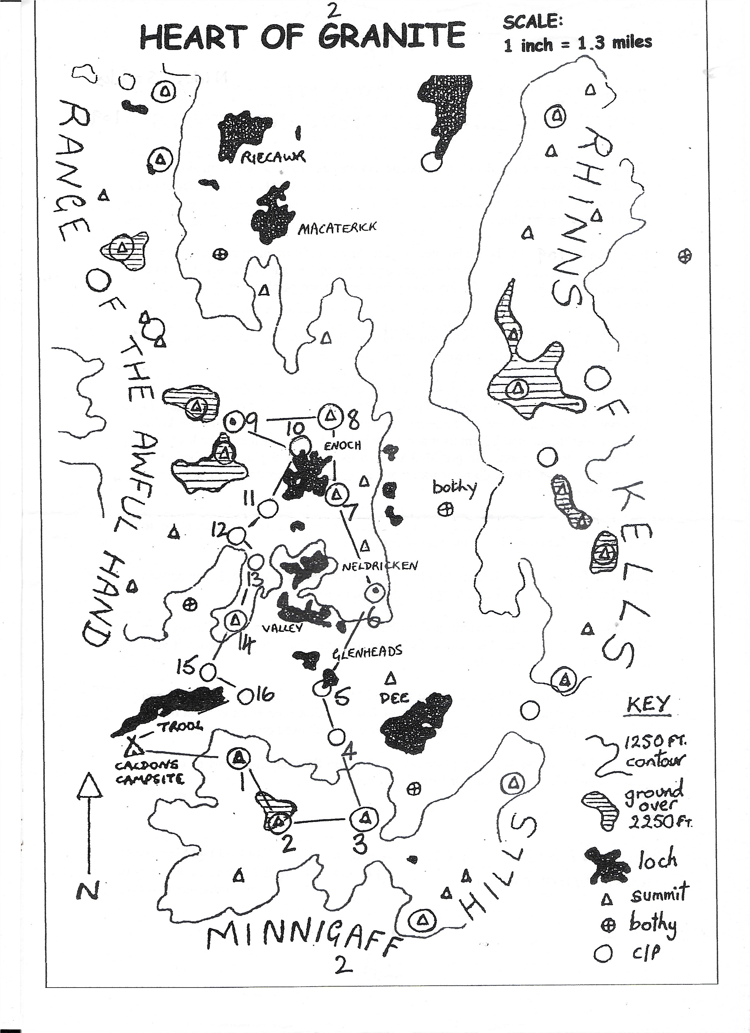
4th March - I had always wanted to introduce the shorter version of Bruce's Crown and we feel that this is the year to do it so I've created a new webpage Heart of Granite Race.htm which has all the information and link to the Si Entry page. It's a challenging route that took me, Bruce and Flynn about 6.30 hours going at a leisurely pace. This is the trace that is shown on the map but you're welcome to try your luck at short cuts! This year, to minimize manpower needed we will have two manned checkpoints and the rest will be recorded by the trackers which every runner will carry. I hope that this classic route will encourage runners to come and discover the delights of the Galloway hills within daylight hours!
 27th
February - Preparations are underway to make this year's event better than last
year. We have invested in a couple of secondhand Gala marquee tents and spent a
day putting them up and making sure they were all complete. We were pleasantly
surprised as apart from needing the usual toggles, pegs and guy ropes there was
more than enough poles, roofs, ends, floor etc to make the two tents which are
10m x 4m and 6m x 6m. We even have spare roofs of 4 x 4 and 6 x 4 as the larger
tent can be used as a smaller tent. Along with my little Gala tent and the MRT
tents we are happy that we have enough to house everyone at the checkpoints and
the Event Centre.
27th
February - Preparations are underway to make this year's event better than last
year. We have invested in a couple of secondhand Gala marquee tents and spent a
day putting them up and making sure they were all complete. We were pleasantly
surprised as apart from needing the usual toggles, pegs and guy ropes there was
more than enough poles, roofs, ends, floor etc to make the two tents which are
10m x 4m and 6m x 6m. We even have spare roofs of 4 x 4 and 6 x 4 as the larger
tent can be used as a smaller tent. Along with my little Gala tent and the MRT
tents we are happy that we have enough to house everyone at the checkpoints and
the Event Centre.
The next job is food and we are determined to feed the runners (and supporters well!) at the checkpoints and the Finish. I have been test making soup (we've lived on it this past week!). Last year it was Spicy Carrot at CP5, Leek and Potato at CP11 and Spicy vegetable chilli at the Finish. This year it's going to be Lentil soup at CP5, Leek and Potato at CP11 and Spicy Vegetable chilli at the Finish. We will have a lot of freshly baked rolls to go with the soup too. We are planning to run a 20 mile Heart of Granite race and fell race runners will get Chunky vegetable soup at the finish. This will be alongside cakes (Lemon drizzle, Orange and Sultana drizzle, Chocolate and Orange drizzle plus many more), bars such as Chia Charge, Stoat and Tesco's finest. Then crisps, juice, tea, coffee etc.
27th January - Talking to lots of people, runners and race organisors about why we're not getting many entries and the general consensus was that it's hard to get a Team of 4 people together, who have availability and are the same pace and want to spend 15 or so hours running round the glorious hills of Galloway. So I came back from the Running Show and put the idea to the Galloway Mountain Rescue team about Teams of 2 (or 3 who run in the Teams of 2 category). And this was approved. Hence I have changed SI Entries and this website. I have requested the change on the Fellrunner, Long Distance Walkers and the Scottish Hill Runners website. I would like to invite pairs of runners to submit their Team entry now.
I am having a meeting with Galloway Mountain Rescue this weekend and we will iron out the finer points but I'm really hoping this creates the interest and the entries that we need to make the race viable.
.JPG) 27th
October - Race preparations are underway and we have received our permit from
Scottish Hill Runners and initial confirmation from Forestry too. Our neighbour,
Chris Shaw kindly made a new base for the trophy and I had a new plaque made
with this year's winners "Girls Night Out" put on it. At the British Fell Relays
I was able to present this to Lisa Watson from that team.
27th
October - Race preparations are underway and we have received our permit from
Scottish Hill Runners and initial confirmation from Forestry too. Our neighbour,
Chris Shaw kindly made a new base for the trophy and I had a new plaque made
with this year's winners "Girls Night Out" put on it. At the British Fell Relays
I was able to present this to Lisa Watson from that team.
22nd August - After talking with Glyn Jones we thought it would be nice to have a record of the completions on the full Ring of Fire route ( GoFar - Ring-of-Fire Round ). I have been in touch with Tony Wimbush who runs the GoFar website and I can have a page on the Bruce's Crown website and he will put the link under the Ring of Fire page on his website. So can anyone who has done the round in previous years or knows runners that have completed it please email me their details - Name, supported, road supported only, date of completion and time? Thanks a lot.
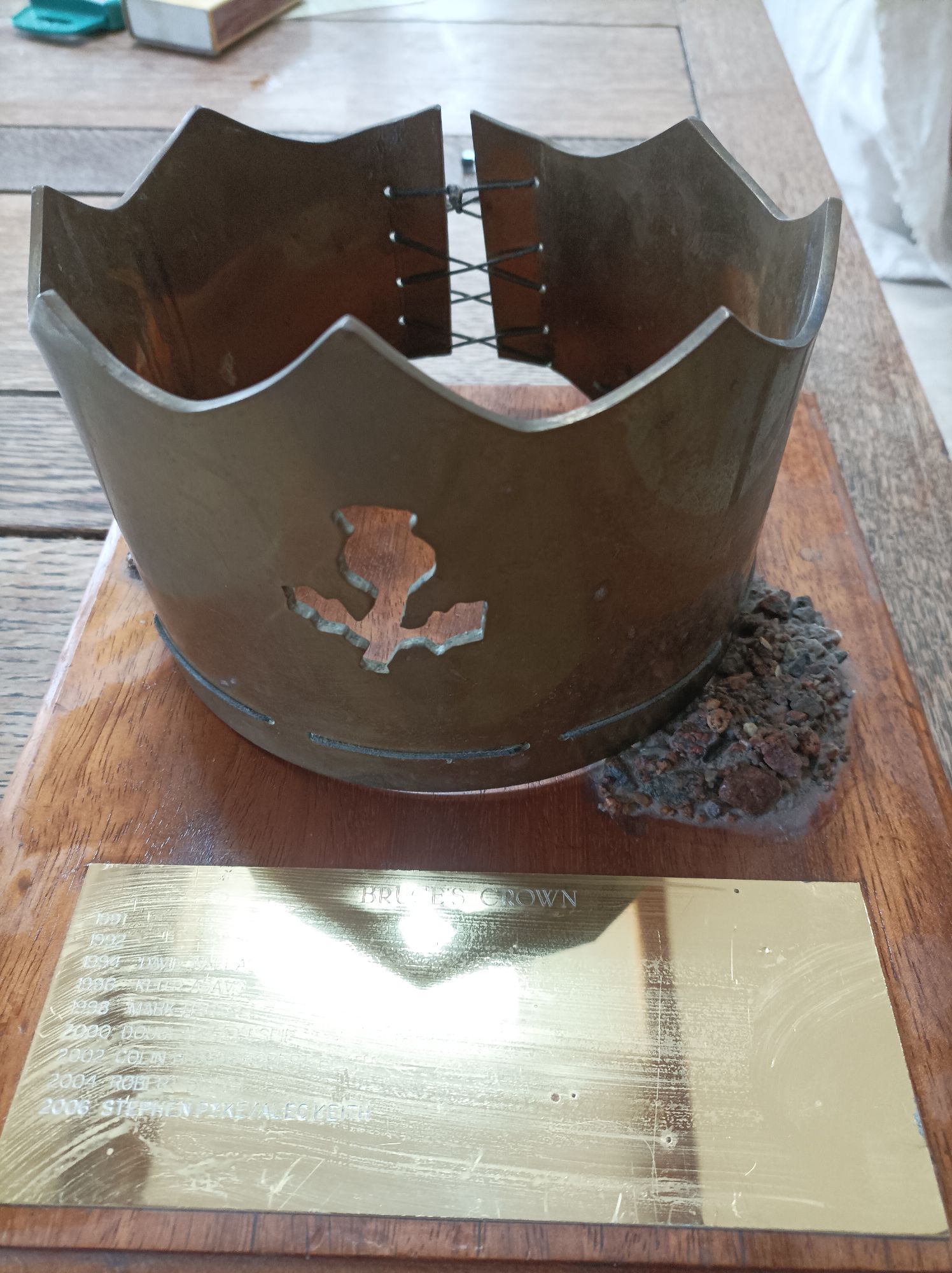
Also we are in the process of getting the trophy mounted on new wood and the plaque transferred over. On the plaque there are the dates 1991 and 1992 but with no name against them. Does anyone know who won the original Bruce's Crown race in those years?
 12th
May 2024 - Entries have gone live on SI Entries
https://www.sientries.co.uk/event.php?event_id=13647
The main change is the Start day which is now Saturday and Time which is now 2pm
for Walkers and 4pm for Runners. This is because we wanted to move the Start
time to earlier so that the Teams are all over the first section in daylight and
therefore it makes sense to move the day to Saturday to help people with travel.
12th
May 2024 - Entries have gone live on SI Entries
https://www.sientries.co.uk/event.php?event_id=13647
The main change is the Start day which is now Saturday and Time which is now 2pm
for Walkers and 4pm for Runners. This is because we wanted to move the Start
time to earlier so that the Teams are all over the first section in daylight and
therefore it makes sense to move the day to Saturday to help people with travel.
As it's possible to enter a Team with one or more members please can people enter when they know they want to take part? That will help us immensely in planning for next year.
5th May - I do now have the trophy in my hands - thanks Spyke and Emma. I will get it polished and engraved before passing onto Girls Night Out for a year!
30th April - Spyke (Stephen Pyke) contacted me as soon as he heard about me resurrecting the Bruce's Crown race as he had won the trophy back in 2006 on the last running of the old race. After much searching in his barn (since he recently moved) he has located the trophy and it's on it's way to me, and then to the new rightful owners - Girls Night Out once I've engraved it. I've got ideas about creating other trophies too so keep watching this space!
I have collated as many photos as I can and added them to a Gallery along with the ones that Eric Murphy took. I hope to add anymore that are sent to me here along the way along with links to race reports that I have found in the Archive reports. I have also written up my race report here - Bruce's Crown2024
And ......2025 entries will open this week on Si Entries and close three weeks before April 4th 2025. We've changed a few small details so I'll update the Information page and put the link to Si Entries up here then.
16th April - I had a meeting with Galloway MRT on Sunday and it's been decided that the date for next year (2025) will be Friday April 4th to Saturday April 5th. Entries will open in May on SiEntries and close in March 2025. Walkers will start from 2pm on Friday and runners from 4pm. Get the date in your diaries and check back here for entries and details in May!!
11th April - Opentracking sorted the Results into a proper order for me here https://results.opentracking.co.uk/event/bcr2024 and I've added Team photos so the results looks good now.
.jpg) 8th
April - We did it! Galloway Mountain Rescue, me and all our helpers organised
the Bruce's Crown race last weekend and eight teams came and tackled the tough
route with the added hardship of Storm Kathleen to deal with. I'm still
recovering from organising and running so it's hard to put into words how happy
I am. It's always stressful organising a race for the first time. I have started
up
www.hoppits.co.uk and
www.marsdentoedale.co.uk but nothing
compared to "Bruce's Crown race with Storm Kathleen". I am so grateful to James
Anderson and Galloway MRT for helping me make some tough decisions about the
possible weather and options that we had. The final decision was to leave the
"low level route" decision to the latest possible time which gave the runners
the best chance of being able to complete the full course.
8th
April - We did it! Galloway Mountain Rescue, me and all our helpers organised
the Bruce's Crown race last weekend and eight teams came and tackled the tough
route with the added hardship of Storm Kathleen to deal with. I'm still
recovering from organising and running so it's hard to put into words how happy
I am. It's always stressful organising a race for the first time. I have started
up
www.hoppits.co.uk and
www.marsdentoedale.co.uk but nothing
compared to "Bruce's Crown race with Storm Kathleen". I am so grateful to James
Anderson and Galloway MRT for helping me make some tough decisions about the
possible weather and options that we had. The final decision was to leave the
"low level route" decision to the latest possible time which gave the runners
the best chance of being able to complete the full course.
We set walkers off at 4pm and then a relaxed approach meant that teams could start when ready, within reason. All the teams wanted to get off asap to do more in the better weather and daylight. From 4pm to 10pm the weather was warm, a bit windy and claggy. But nothing too awful. The terrain and navigation is the most challenging on the first leg but all the teams succesfully got to CP5 on the Dee Bridge track where there was a checkpoint with hot soup, drinks, cake etc. One team retired here so there were seven teams that carried onto Leg 2. Around the time the teams arrived at checkpoint 5 the rain started (10 to 10.30pm) and it hammered it down for six hours as the teams were crossing the Corserine ridgeline. After the initial two tops of Darrou and Miekle Milleau the route follows a ridge which has short grass and a well defined path so "better" terrain than a lot of the first leg meaning you can move faster. The rain and increasing wind meant that the teams had a torrid time and arrived at CP11 on the track wet through and needing sustenance. This they received in quantity and quality from MRT with more soup, hot drinks, cakes and snacks. Another two teams had to drop here due to sickness and injury so five teams headed down the 5 mile valley track to CP12. This section I thought everyone would hate, but actually it was a godsend in the weather to be able to have a break from navigating and be able to digest food and keep moving. CP12 was a smaller checkpoint with hot drinks and snacks before teams headed onto the final stretch up Shiel Hill, Craigmansheenie and onwards and upwards to Merrick. The rain stopped at 6am when the skies cleared and the tops could be seen from the valley. Unfortunately the winds were forecast to pick up around 11am and a decision was to be made then. At this stage there were three Ladies Teams, one Mixed team and one Male team left in the race. One ladies team decided to stop before Craigmansheenie and took a safe route back to the CP12. Four teams then made it over the final hills and were rewarded with clear views, a little sunshine and extremely strong, gusty winds. Shallock on the Minnoch was the worst hit as it's a big round plateau with no shelter. Once off there the teams were slightly sheltered by Merrick and even the summit of Merrick was not the worst place to be. Surprisingly halfway down Merrick to Bruce's Stone carpark the wind was pushing the teams uphill and this was extremely tiring. At the last checkpoint the Bruce's Stone the teams were met by Glyn Jones, the creator of the Rings of Fire round and the first race organisor for the Ring's of Fire races which comprised of the Bruce's Crown and the Heart of Granite. They then had a hard slog down the road / footpaths back to Caldons and a warm welcome at the Finish.
All the results are on Opentracking https://results.opentracking.co.uk/event/bcr2024 and the tracking can be viewed here https://live.opentracking.co.uk/bcr2024/ . I hope all the teams that didn't make it come back next year to get the job done and I thank all the runners for entering, preparing, running and making good hill decisions. It's a tough event and the weather made it doubly tough. Well done to all of you, no matter how far you got.
.JPG) Thank
you to https://gallowaymrt.org.uk/
for joining me in organising the race, especially Karen Brownlie, James Anderson
and Ross McConchie who made up the core team from the beginning (November 2023).
And to all the Galloway MRT team members who turned out on the day to make it
happen. They were incredible out on the hill and in the checkpoints. My thanks
go to Teresa Wall and Nick Whittingham along with Charlie Elliot who travelled
from Yorkshire to help out and my neighbour Rus. There are many other personal
friends of MRT who baked cakes, donated equipment and helped out.
Thank
you to https://gallowaymrt.org.uk/
for joining me in organising the race, especially Karen Brownlie, James Anderson
and Ross McConchie who made up the core team from the beginning (November 2023).
And to all the Galloway MRT team members who turned out on the day to make it
happen. They were incredible out on the hill and in the checkpoints. My thanks
go to Teresa Wall and Nick Whittingham along with Charlie Elliot who travelled
from Yorkshire to help out and my neighbour Rus. There are many other personal
friends of MRT who baked cakes, donated equipment and helped out.
Thanks to our very generous sponsors Crafty Distillery for Finishers gin miniatures and Overall winners prize, along with Inov-8 for Ladies, Mens and Mixed prize vouchers. We had donations of food from Tesco in Castle Douglas, Co-op in Newton Stewart, William Lindsay Family Butchers in Creetown and Chia Bars. Thanks to Dabby of Dabhands blog for taking photos and organising everyone into taking more! Also to Eric Murphy https://ericmurphy.co/ who popped up on the first climb and last descent. I will upload his photos to a gallery here soon. Thanks also to Chris and his team at https://www.facebook.com/EFARScotland for First Aid cover.
4th April - We have been studying the weather forecast and if the winds are making it impossible to summit Merrick we have a low level route from Shallock on the Minnock, to the fence line which leads to Loch Enoch and then down the valley on a footpath which turns into a forest track to above Culsharg bothy where you pick up the tourist path to Bruce's Stone carpark and onto Caldons. This is the Low level route 1 to 40,000.pdf map and a Level route 1 to 25,000.pdf map with the detail to Culsharg bothy shown. If you can please print off a couple of maps and mark up your Harveys map with this route. We understand it is very late in the day so we will hope to have two maps per team to hand out at Registration and you will be told at CP11 whether you are using the low level route.
1st April - OpenTracking have sent me the link to the public webpage https://live.opentracking.co.uk/bcr2024/ This shows the Team Leader who will be tracked and timed and then all the Team members who will be tracked but their timings don't show on the Leaderboard, otherwise it just gets too cluttered. The line is roughly the suggested route but it's not 100% accurate so we will divert off it in places.
Other than that things are getting there - we are going to have hot drinks and soup at Checkpoint 5 and 11. With hot drinks and snacks at CP12. There will be quite a lot of various food like bananas, Tunnock wafers, sweets, coke, Iron Bru, small cakes, traybake lemon drizzle, orange and sultana, chocolate cake, flapjack at these checkpoints as well. At the Even Centre there will be hot drinks etc at the start and then hot food (vegetable chilli and vegan option) at the Finish.
26th March - We're getting there. I have added Start Times to the Race Information page and below. You can start anytime within your Start Window. Let me know if you can't make the time because of Travel. I have added cup to the Kit list as the checkpoints will have limited cups for soup and not for hot drinks. I have also added a FAQ page and answered the questions that I have been asked via email. If you can't find something and would like an answer then please email me and I'll reply and add it to the FAQ too. I will be sending out an email before the race but just want to get things on here first so the email contains everything.
| Team Name | Start Time | Window |
| Apocalypse Now | 16:00 | 16:30 |
| Seaforth | 16:30 | 17:00 |
| Carnethy Mixed | 17:00 | 17:30 |
| Ladies from the Dark Side | 18:00 | 18:30 |
| Merrick Muppets | 18:30 | 18:45 |
| Carnethy Roughgrounders | 18:45 | 19:00 |
| Bog Hags | 19:15 | 19:30 |
| The Four Tussockteers | 19:30 | 19:45 |
| Girls Night Out | 19:45 | 20:00 |
11th March - I have added the Timings to a page of their own Pre Race Timings to help people/teams decide when they would like to set off. Personally I think between 5pm and 7pm is good. But it will depend on when the Teams can get here.
 7th March - yesterday we (Steve and I) tested two trackers to find out where the
dead spots are and also to make sure the checkpoints that are given on the
Information page and the tracking map reflect the physical object that we find
on the ground. I set off from Caldons (the Start) and ran to the bottom of Sheil
Hill where I left the route. Steve started at the bottom of Sheil Hill and
walked to Caldons. We then drove our respective vehicles home. The forecast was
for clag lifting to sunshine and it was correct although the clag seemed to be
annoyingly off every summit for both of us until 1pm! I will put the timings up
when I have downloaded them to help people figure out how long they will be out.
I will be asking Teams when they would prefer to set off. We would like Teams to
finish before 2pm on Saturday but apart from that we are flexible as we know
people have to travel etc. We are hopeful that the Forestry will let us allow
runners to camp at Caldons overnight which should help logistics.
7th March - yesterday we (Steve and I) tested two trackers to find out where the
dead spots are and also to make sure the checkpoints that are given on the
Information page and the tracking map reflect the physical object that we find
on the ground. I set off from Caldons (the Start) and ran to the bottom of Sheil
Hill where I left the route. Steve started at the bottom of Sheil Hill and
walked to Caldons. We then drove our respective vehicles home. The forecast was
for clag lifting to sunshine and it was correct although the clag seemed to be
annoyingly off every summit for both of us until 1pm! I will put the timings up
when I have downloaded them to help people figure out how long they will be out.
I will be asking Teams when they would prefer to set off. We would like Teams to
finish before 2pm on Saturday but apart from that we are flexible as we know
people have to travel etc. We are hopeful that the Forestry will let us allow
runners to camp at Caldons overnight which should help logistics.
I took loads of photos and I have written up some notes here. Route notes.htm
27th February - I am having regular meetings with Galloway Mountain Rescue and the event is taking shape. The Forestry are being very co-operative which we are very grateful for and Inov-8 have offered prizes to the winning Open, Ladies and Mixed Teams. I've decided to upload the maps that I have made from my recce back in 2023. These are on the Race Information page and they can be printed off and used on the race itself but do note that the purple line drawn is the suggested route. You do not have to follow it. I just want this first year to go smoothly and I want to encourage more teams to enter. We will run the event with the entries that we have but half the reason for putting on Bruce's Crown is to raise money for Galloway Mountain Rescue so we really do not want to run at a loss!
.JPG) 10th
February - the last bit of route checking for organising purposes was to see
what the flags were like on the descent from the mast on Bennan to the Bruce's
Stone carpark. I carried Bruce in his rucksack most of the way up and then back
to the big deer fence stile. He was quite happy! The weather was foul and it was
pretty hard work - hopefully it won't be like this in April! I haven't been that
way since the Merrick Hill race in September and the path is much more defined
than it was before the race. There are also a number of canes with either red
and white tape or yellow tape. Since everyone will be in daylight I think it
will be easy to follow the flags and the path down.
10th
February - the last bit of route checking for organising purposes was to see
what the flags were like on the descent from the mast on Bennan to the Bruce's
Stone carpark. I carried Bruce in his rucksack most of the way up and then back
to the big deer fence stile. He was quite happy! The weather was foul and it was
pretty hard work - hopefully it won't be like this in April! I haven't been that
way since the Merrick Hill race in September and the path is much more defined
than it was before the race. There are also a number of canes with either red
and white tape or yellow tape. Since everyone will be in daylight I think it
will be easy to follow the flags and the path down.
To find the path you cross the deer fence on the huge stile, head up the track and just at the end of the loch which is on the right, the path starts there and goes left. It contours and drops along the plateau before dropping steeply to a deer fence stile, then down the side of that deer fence to cross the forest track and continue on the other side. Here it goes right and along the ridge line before plunging left down a steep and very tussocky descent. The path makes this a lot easier. Then you bend right onto a good grassy path down through the bracken to the top carpark. Bruce's Stone is a checkpoint (you've got to visit the namesake of the race and it's not far out of your way!). Then down to the road and left on the well signposted footpath which takes you to Caldons Campsite. Photos with description in the file name of Bennan descent
If you are thinking of putting in a team then please can you do so - even if you just enter the Team Leader's details? This is so we have an idea of numbers for catering, toilets, trackers etc. Thank you.
.JPG) 3rd
February - Steve and I have been reccying again - Shiel Hill this time. And
again I know it's a navigation event but for this first one, because it's in two
months time so people haven't much time to recce and because I don't want teams
turning round halfway up Shiel Hill and heading back to the safety of MRT in the
valley (!!!) I have cut back the worst of the brash on this ascent and partially
marked it. This is because on the map it looks a simple "follow the stream up"
decision but in reality there are too many dense trees near the stream and it is
not possible to stay near the stream. I have taken photos and labeled them in
order. Basically
3rd
February - Steve and I have been reccying again - Shiel Hill this time. And
again I know it's a navigation event but for this first one, because it's in two
months time so people haven't much time to recce and because I don't want teams
turning round halfway up Shiel Hill and heading back to the safety of MRT in the
valley (!!!) I have cut back the worst of the brash on this ascent and partially
marked it. This is because on the map it looks a simple "follow the stream up"
decision but in reality there are too many dense trees near the stream and it is
not possible to stay near the stream. I have taken photos and labeled them in
order. Basically
Photos with descriptions in the file name - Shiel Hill recce
2nd February - I have had an email asking whether there is any rules over the make up of a Mixed Team. Basically any combination of men and women makes a Mixed Team. I've added this information to the Information page too.
We have also changed the SI Entries entry process so that the Team Captain can enter a Team without completing all Four Team member details until a later date. This helps the Team Captain as gathering all the information asked is sometimes a lengthy process and means changes can be made until mid March. If you do this we will check the experience later of the added Team Members but so long as two or more members are well experienced we are considerate in our appraisal.
 30th
January - I know this is a navigation event however anyone that knows Galloway
will also know that direct lines on a compass bearing can be horrendous. There
are a couple of such descents and I've found this to my cost coming off
Cairngarroch a couple of years ago hence I found the way to the "Outdoor centre"
last year. This is a reliable route as you only have to find the top of the
stream and it leads you down to the gully and the house / fields. However you
then have 2km on the track to do.
30th
January - I know this is a navigation event however anyone that knows Galloway
will also know that direct lines on a compass bearing can be horrendous. There
are a couple of such descents and I've found this to my cost coming off
Cairngarroch a couple of years ago hence I found the way to the "Outdoor centre"
last year. This is a reliable route as you only have to find the top of the
stream and it leads you down to the gully and the house / fields. However you
then have 2km on the track to do.
So as I was keen to get back on the mountains and Tuesday being the "best" weather day Steve and I drove round to Clatteringshaws loch and climbed Cairngarroch. The summit has a big cairn on it but it was cold and I didn't get a good photo (sorry!). Then we descended down on what was described by Galloway Mountain Rescue as "good ground near the forest". We headed off passed the lochan / boggy area and gently down and across. It's ok going with grass and small tussocks. You arrive at the felled forest and a cairn. I would avoid the felled area as its been pretty trashed. There was a few deer trods alongside and then down. We found grassy and bracken ramps to descend on. When you get to the still standing forest you can either go in the forest or down the side, which has been planted up but it's ok. And you get to the forest track without much difficulty. There will be a Checkpoint probably at the track junction before the bridge with hot food etc on the race.
And then the Ascent of Darrou. In August when I did the recce I went along the forest track to the standing forest where there is a track leading into the forest. That ends and you head up the forest to the end edge where an old forestry track traverses back towards the stream / quarry. I followed this and crossed the stream. It was then pretty tussocky up to the plateau. Looking at it now you could stay on the right of the stream in the bracken which would be better. In August the bracken was too high.
But another route and one that was ok today was to go into the quarry and follow the tracks leading right, then zig zags. Then through the few trees that are left and climb higher. You need to start traversing right at some point. We went quite high up and traversed. There are lots of deer trods and you can swop from one to another through the tussocks. The tussocks get smaller the higher you go. The summit has three big rocks and some smaller ones on it.
Photos with descriptions in the file names - Cairngarroch and Darrou
 27th
January - Thinking about the Start times and if Teams are struggling to get up
on Friday evening we can start you off later into the night. We would like
everyone to have finished by 4pm on Saturday and I took 15 hours in August to
run the route. So I think running teams can be set off up to midnight if that
helps with logistics.
27th
January - Thinking about the Start times and if Teams are struggling to get up
on Friday evening we can start you off later into the night. We would like
everyone to have finished by 4pm on Saturday and I took 15 hours in August to
run the route. So I think running teams can be set off up to midnight if that
helps with logistics.
If anyone wants to recce and needs help with route or logistics then contact me on nicky@brucescrown.co.uk
I visited Caldons House on Friday 26th January and spoke to the lady there who remembered the OMM fondly and was very happy for us to set up the Event centre on the area below her house. The start also runs through her garden which she is more than happy with too. I called in at the Glentrool Hive and asked about using the showers there (they also have self catering unit available) and also at the https://www.Glentrool Camping and Caravan Site.co.uk/ who said they have 30+ camping pitches for anyone that wanted to camp on the Saturday night / Sunday night.
24th January - so while I was on the Spine Galloway Mountain Rescue have got the entries up and running on SIEntries https://www.sientries.co.uk/event.php?elid=Y&event_id=12973 and I have entered my team "The Four Tussockteers"! I am on the Pre-Selection list at the moment.
I am going to visit Caldons Campsite this week and check the route from the start. I have also been thinking of accommodation and can see that https://www.Glentrool Camping and Caravan Site.co.uk/ have availability for that weekend. The other option I want to check out is the https://www.Glen Trool Hive.co.uk/ as they have showers and it would be nice I think if we could offer showers to runners when they finish.
5th January - Things are progressing on all fronts. I am having regular meetings with Galloway Mountain Rescue and we're working through all the organisational tasks. Forestry Land Scotland have been in contact and everything seems to be progressing well there. I've got the backbone of the website up and running! And I'l get a Certificate organised so it shows as a Safe website. The route is up so reccies can begin! I will tape the ascent to Shiel Hill through the forest! Entries will open shortly on Si Entries once the Entry page is created etc.